
No Vacancy
Current Vacancies
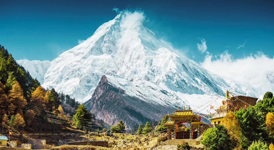
Manaslu Circuit Trek In Monsoon: Is It Possible? Weather, Trail Conditions, and Risks Explained
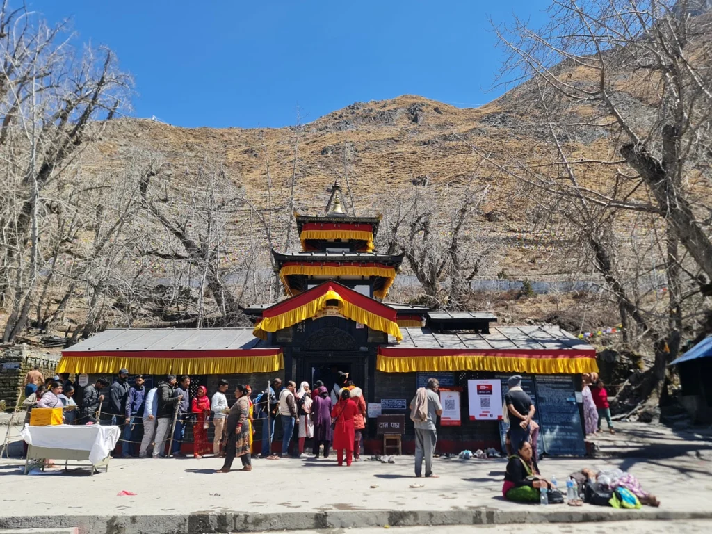
The Manaslu Circuit trek is a remote journey that circles the eighth-highest mountain in the world, Mount Manaslu (8,163 m). This trek is Nepal’s most spectacular adventure that provides you with a stunning view of the Himalayas, the diverse landscape of Nepal, and a moment to explore remote villages and the culture of the local people. The Manaslu Circuit trek is located in a restricted area of Nepal, the Manaslu region, and takes you to the highest point of Larkya La Pass (5,106 m), where the weather, terrain conditions, and high altitude pose several challenges. While spring (March to May) and autumn (September to November) are the best seasons for the Manaslu Circuit Trek, Monsoon (June to August) can be challenging due to severe weather, risk of landslides, slippery trails, and floods in the lower regions.
This blog provides information about the Manaslu Circuit Trek during the monsoon, including weather, trail conditions, and risks. The possibility of trekking in the Manaslu region during the monsoon and the rewards it offers, along with safety tips, is also provided.
Manaslu Monsoon Trek
| Feature | Details |
| Region | Manaslu Conservation Area, Gorkha, Nepal |
| Trek Duration | 13 to 17 Days |
| Monsoon Season | June to August |
| Highest Point | Larkya La Pass (5,106 m) |
| Difficulty Level | Moderate to Challenging |
| Weather | Humid weather with frequent downpours in the lower region. Cool, dry, and heavy fog with the possibility of wind and snowfall in higher elevations. |
| Trail Conditions | Muddy, slippery, and leech-infested routes |
| Crowds | Lower in comparison to Spring and autumn. |
| Accommodation | Lodges, homestays, and teahouses |
| Permits Required | Manaslu Restricted Area Permit (RAP)Manaslu Conservation Area Permit (MCAP)Annapurna Conservation Area Permit (ACAP) |
| Guide Requirement | A licensed guide is mandatory for the Manaslu Circuit trek |
| Best For | Highly experienced trekkers seeking adventure and solitude experiences, and enjoying the vibrant and lush landscape of the rainy season. |
Is the Manaslu Circuit Trek Possible in the monsoon?
The Manaslu Circuit trek can be challenging in the monsoon due to various factors like weather, trekking routes, trails affected by landslides and floods, and infestation of leeches. But the trek is possible with proper preparation and also rewards you with a unique experience of a vibrant and lush green landscape, peaceful trails, and views of waterfalls.
The preparation for the Manaslu Circuit trek in monsoon includes trekking with proper gear and equipment, an experienced licensed guide, proper permits, and physical preparations. Adding buffer days and trekking with proper insurance is also important to compensate for delays and get evacuation in case of emergency.
Weather on the Manaslu Circuit Trek in Monsoon
Weather on the Manaslu circuit trek in the monsoon season is challenging due to severe weather that changes according to elevation. In lower regions like Soti Khola and Deng, you may experience heavy rain with a high risk of landslides and floods. The average temperature ranges from 20°C to 28°C in the lower region. As you trek to a higher region, crossing Namrung village, you experience cooler air, but with dense fog and clouds mostly during the afternoon.
In the upper valleys, the partial rain shadow region, the chances of rainfall are low, but the temperatures are cold, ranging from 0°C to 10°C during the day and lower at night. Strong winds and chances of snowfall are high in the higher altitudes.
Trail Conditions During the Monsoon
The trail conditions in the Manaslu Circuit Trek during the monsoon are full of challenges. From slippery, muddy, and leech-infested trails to landslides and the chance of floods, you need to trek with caution.
Lower Section
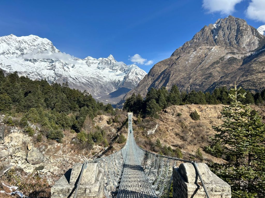
The lower to mid sections, like Machha Khola (870 m) to Namrung (2630 m), experience most of the muddy and slippery sections due to heavy rain. As the forests are dense, this section has a higher chance of leech infestation, landslides, and flooding due to the rising level of water. This requires you to be cautious when walking on slippery paths and crossing suspension bridges.
Upper Section
The upper section of the trail from Samagaon (3,530 m) to Larkya La Pass requires walking through fewer muddy sections and rocky trails. Trails in higher passes are also covered with slippery snow and icy sections with high winds, making the path slippery and colder, requiring physical effort.
Major Risks and Benefits of Trekking the Manaslu Circuit in Monsoon
The condition of the route, weather, and chance of natural calamities increase the risk in the Manaslu circuit trek in the monsoon. Meanwhile, the monsoon also benefits trekkers with the peaceful trail, view of the waterfall, fresh mountain air, and solitude experience.
| Challenges | Benefits |
| Slippery and muddy trails | Fewer crowds, giving a peaceful trekking experience |
| Landslides and floods | Lush green forests and beautiful landscapes when the weather is clear |
| Leeches and other pest infestations | Spectacular waterfalls throughout the route |
| Cloud cover reduces mountain views | Fresh mountain air after rainfall |
| Limited service in the teahouse or accommodation due to the off-season | Easier availability of teahouses |
| Chance of delay in the trek | Opportunity to witness the unique beauty of the Manaslu region |
Tips for Safe Trekking
Trekkers or adventurers planning for the Manaslu circuit trek in the monsoon can follow the trekking tips below for a successful and safe trek to the Manaslu region of Nepal:
- Trek with a licensed and experienced guide
- Plan for extra days to accommodate delays in your itinerary
- Select a well-planned itinerary with proper acclimatization.
- Carry essential trekking gear and equipment.
- Check the weather forecast, notices, and information about the trail conditions
- Trek with the necessary permits and comply with the rules
- Avoid late-hour treks and end treks during daylight
- Stay hydrated and walk at a proper pace
- Carry medication, anti-insect, or leech protection spray or creams if available
Conclusion
Manaslu Circuit Trek during the monsoon is challenging, but it is possible and also rewards trekkers with unique moments and experiences. Muddy and slippery trails and weather delays, landslides, and floods are key challenges, but the season also rewards with peaceful trails, a vibrant atmosphere, lush greenery, and fresh mountain air. With proper physical and mental preparation, trekking with gear, a well-planned itinerary, and an experienced guide, you can enjoy the beauty of the Manaslu region during the monsoon.
Planning for the Manaslu Circuit Trek during monsoon? Trekkers Nepal provides you with a well-planned and tailored itinerary, expert advice, an experienced guide, and logistic support and arrangements to make your trek adventurous, comfortable, and memorable.
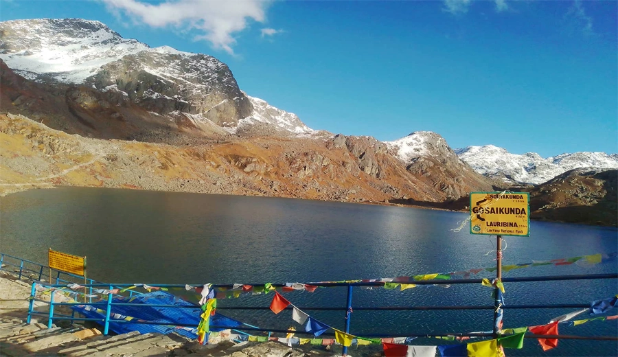
Gosainkunda Lake Trek : Complete Guide to Routes, Cost & Best Time
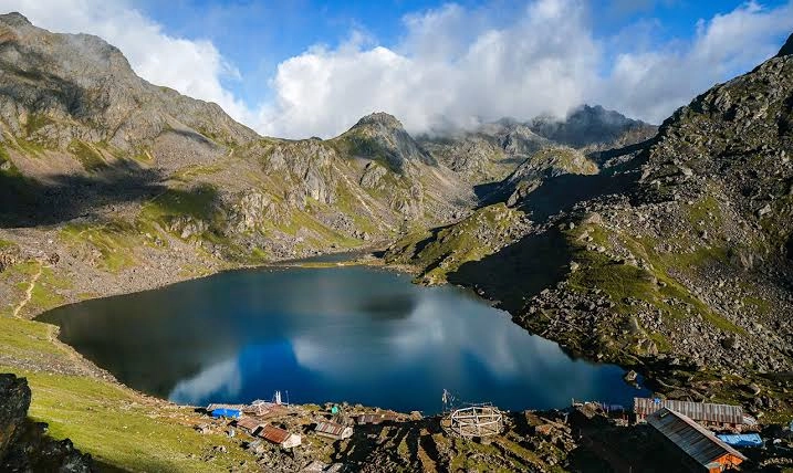
The Gosainkunda Lake trek is a rewarding and memorable experience in Nepal’s Langtang region. Gosaikunda Lake (4,380 m), in the Rasuwa district of Nepal, provides a jaw-dropping view of the Himalayas along with deep cultural and spiritual meaning, as the lake is one of the sacred destinations for Hindu and Buddhist followers. You trek through dense rhododendron forests, charming villages, and high-altitude alpine landscapes. This moderately difficult trek to the pristine glacier lake of Gosaikunda gives you an unforgettable experience of the Himalayas.
This guide provides information about the Gosaikunda Lake trek in the Langtang region of Nepal. The best time to visit, itinerary details, permit requirements, difficulties, and preparation guides are also provided.
Gosaikunda Lake Trek
| Trek Overview | Details |
| Trek Region | Langtang National Park, Rasuwa district, Central Nepal |
| Maximum Altitude | 4,380 m (Gosainkunda Lake), 4,610 m (Lauribina Pass Trek) |
| Trek Duration | 5 to 7 Days |
| Trek Difficulty | Moderate |
| Best Seasons | Spring (March to May) Autumn (September to November) |
| Starting and ending point | Dhunche (2030 m) |
| Popular Attraction | Bhairabh Kunda, Sing Gompa, Lauribinayak, and other lakes |
| Accommodation | Guesthouses, Tea Houses, and Lodges |
| Permits Required | Langtang National Park Entry Permit, TIMS, Shivapuri Nagarjun National Park Entry Permit (Only if you trek via Sundarijal, Kathmandu) |
| Transportation | Drive from Kathmandu to Dhunche |
| Suitable For | Beginners with good fitness, families, nature lovers, and pilgrims |
Why Choose the Gosainkunda Lake Trek?
For one seeking a pristine environment, breathtaking Himalayan scenery, and cultural and spiritual immersion, the Gosaikunda Lake trek is definitely the ideal choice. The trek takes you to the Langtang National Park in the Langtang region and lets you witness the crystal-clear glacier lake in the high-altitude Himalayas. You walk through several Tamang settlements, monasteries, chortens, and viewpoints that offer close views of Langtang Lirung, Ganesh Himal, Manaslu, and other snow-capped mountains.
The Gosaikunda Lake trek is a short and moderately difficult trek that requires basic to medium physical fitness, and those with limited time may prefer the trek. Unlike treks like the Annapurna Base Camp trek and the Everest Base Camp trek, the Gosaikunda Lake trek is peaceful and close to Kathmandu.
Best Time for the Gosainkunda Lake Trek
Like most trekking destinations in Nepal, the best time for the Gosainkunda Lake trek is during Spring (March to May) and Autumn (September to November). While Monsoon season marks a peak religious and spiritual time, the season challenges trekkers with slippery trails, risk of floods and landslides, and contact with pests.
Spring
Spring (March to May) is the ideal season for the Gosaikunda trek, as the season rewards trekkers with a vibrant atmosphere, pleasant weather, and the colorful hue of rhododendron and wildflower blooms. The skies are clear, and mountain visibility is great during the season. Spring offers the best moments for photography and for feeling the colorful vista of the Langtang region during the Gosaikunda Trek.
Autumn
Autumn, from September to November, is marked as an ideal season for visiting Gosaikunda Lake. Trekking in the autumn gives cool weather with crystal-clear mountain and landscape views. The trails are dry and comfortable during the season. Also, autumn provides you with an opportunity to witness various cultural and religious festivals, adding charm to your journey.
Monsoon and Winter
Monsoon from June to August, also experiences huge numbers of religious visitors or pilgrims in Gosaikunda Lake. Pilgrims from all over Nepal and India visit the sacred lake on the occasion of Janai Purnima, a sacred Hindu festival. During the monsoon, the landscape is green, but the chance of rain, slippery surfaces, and pest infestation is high. The humid temperature and poor visibility due to fog can also disrupt mountain views and scenery.
Be Part of the Holy Gathering at Gosaikunda — Plan Your Sacred Gosaikunda Lake Trek with Trekkers Nepal
Similarly, winter from December to February can be ideal for breathtaking Himalayan views. But the temperatures are extremely cold, and routes are full of ice or snow, making navigation difficult.
Gosainkunda Lake Trek Itinerary
The highly recommended route for the Gosaikunda Lake trek is via Dhunche, Rasuwa. While the journey begins with a 7-to 9-hour drive to Rasuwa, the actual trek journey begins in Dhunche. The brief Gosainkunda Lake Trek Itinerary is provided below:
Day 1: Drive from Kathmandu to Dhunche (2,030 m)
A scenic drive from Kathmandu reaches the trailhead, Dhunche, in the Rasuwa district of Nepal.
Day 2: Trek from Dhunche to Chandanbari/Sing Gompa (3,250 m)
The trek begins from Dhunche with a steep ascent where you pass through rushing streams and dense pine and rhododendron forests to reach Chandanbari/Sing Gompa.
Day 3: Trek from Chandanbari to Lauribinayak (3,910 m)
A 4- to 6-hour hike from Chandanbari reaches Lauribinayak, from where you get a stunning view of mountain vistas.
Day 4: Trek from Lauribinayak to Gosaikunda Lake (4,380 m)
A short but steep hike to reach the sacred lake premises of Gosaikunda.
Trek Duration: 3-4 hours
Day 5: Exploration and Return to Lauribinayak or Sing Gompa
Explore the nearby lakes, enjoy the stunning Himalayan view, and descend to the Sing Gompa.
Day 6: Trek down to Dhunche
Final day of trekking, where you descend to reach Dhunche, the ending and resting point of the trek.
Day 7: Drive from Dhunche to Kathmandu
Drive back to Kathmandu via an identical drive journey while concluding your Gosaikunda trek.
Gosainkunda Lake Trek Permit Requirement
You are required to obtain mandatory permits to legally enter and trek to the Gosaikunda Lake. As the trek is located in the Langtang region of Nepal, you are required to obtain the following permit:
| Permits | Cost |
| Langtang Conservation Area Permit | NPR 3,000 for foreigners NPR 1,500 for SAARC citizens NPR 100 for Nepali citizens |
| Trekkers' Information Management System (TIMS) Permit | NPR 2000 for foreigners NPR 1000 for SAARC citizens |
| Shivapuri Nagarjun National Park Entry Permit (Only if you trek via Sundarijal, Kathmandu) | NPR 1000 for foreigners, NPR 600 for SAARC citizens NPR 100 for Nepali citizens |
Essential Travel Tips
If you are planning for the Gosaikunda Lake trek in the Langtang region of Nepal, following the essential travel tips below can make your journey safe and comfortable:
- Choose the spring and autumn seasons for a comfortable trek and the best weather
- Obtain the required permit and documentation for trekking in the region
- Include proper acclimatization and rest in your itinerary
- Stay hydrated and maintain pace
- Begin the trek in the early morning and avoid trekking in the dark.
- Respect local customs and beliefs related to Gosaikunda Lake
- Get updated weather reports during the trek
Conclusion
The Gosaikunda Lake trek in the central region of Nepal is one of the shorter and moderately difficult treks full of adventure and cultural exploration. You witness peaceful and traditional Tamang villages, a calm environment, and the spiritual environment of a sacred glacier lake surrounded by snowcapped peaks. Choosing the best season to trek, physical preparation, and a well-planned itinerary help to make your journey comfortable, safe, and memorable.
Trekkers Nepal provides a well-planned itinerary, expert local guides, and authentic Himalayan experiences. Plan your Gosaikunda Lake trek today with Trekkers Nepal and make your journey meaningful and full of memories.
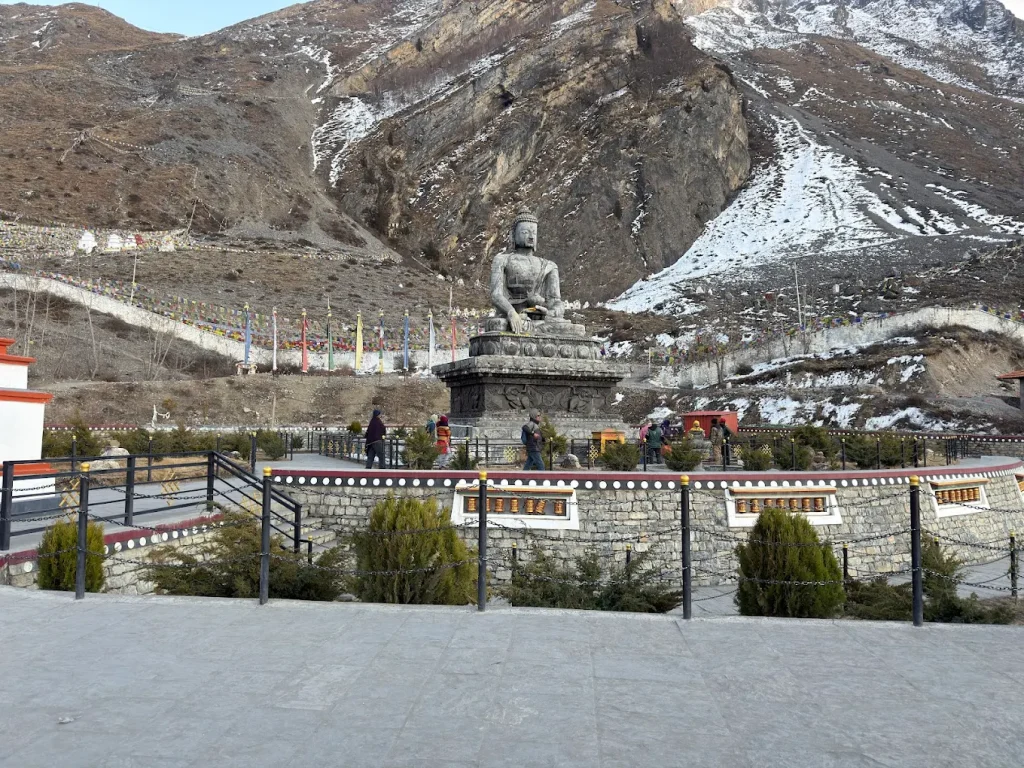
Muktinath Helicopter Tour From Pokhara 2026/27: Cost, Itinerary, And How to Book
Is Muktinath your dream destination where you want to travel to enhance your devotion and increase spiritual awareness while enjoying the beautiful scenery of the region? You are not alone, as the place is on the bucket list of everyone in 2026/27. Whether you are visiting there to worship or to enjoy the beautiful scenery and feel the spiritual essence of the place, reaching there is not as easy as you think.
While roads are better in recent days, the narrow paths, bumpy sections, high-altitude regions, and requirement of multiple days of travel are not what anyone can handle. If you feel motion sickness while traveling in cars or buses, the road journey further exacerbates your sickness with curvy and bumpy roads. In addition to that, a road journey is time-consuming and is not for someone who has limited time. A helicopter tour from Pokhara to Muktinath can be the ideal choice, as it is the fastest and safest way to travel. Helicopter tour to Muktinath is an adventurous, memorable, and hassle-free experience for anyone with limited time, problems in a road journey, and a desire for a comfortable experience.
In this blog, we provide information about the Muktinath helicopter tour from Pokhara in 2026/27. The benefit of the Muktinath heli tour, its cost in 2026/27, its itinerary, and its best time, along with tips for a comfortable journey, are also provided.
Why Choose a Muktinath Helicopter Tour from Pokhara?
A helicopter tour from Pokhara to Muktinath (3,800 m) is one of the fastest and most comfortable ways to travel long distances without various complications. Heli tours are also a new experience that offers a scenic aerial view of the unique landscape of Nepal. The benefits of the Muktinath Helicopter tour are provided below:
Fastest Way to Reach Muktinath
A helicopter tour from Pokhara to Muktinath is one of the fastest and most comfortable ways one can reach Mustang, the place where the Muktinath Temple resides. While the road journey takes an average of two days from Pokhara, a helicopter takes around 40 to 45 minutes. This means you can visit Muktinath Temple, spend a few hours there, and return to Pokhara within 4 to 5 hours. This saves your time and removes traveling hassles while also eliminating the risk of poor road conditions and motion sickness.
Comfortable and Convenient
Unlike long days of road travel on bumpy and curvy roads, Heli tours are comfortable, relaxing, and give an exciting experience with a bird's-eye view of the surroundings. For one with difficulties in long-day travel, limited mobility, motion sickness, and limited time, a helicopter tour is an ideal and convenient option.
Spectacular Himalayan Views
The Muktinath helicopter from Pokhara is a completely new experience that gives you a stunning aerial view of the Himalayas. You get a close view of mountain ranges like Annapurna, Dhaulagiri, Nilgiri, and Tukuche, and the unique terrain of the Mustang region above the sky. You can record the views and make unforgettable memories of the heli tour to Muktinath.
Muktinath Helicopter Tour Cost 2026/27
If you are planning a Heli tour in 2026/27, knowing its cost is important to plan the tour within budget. The cost of a heli tour depends upon various factors such as route, nationality, season, airlines, and type of booking, such as a shared or private charter.
Shared Group Joining Cost
Shared group heli tour from Pokhara to Muktinath is ideal and affordable for an individual traveler or a small group. The estimated cost of a shared group joining a helicopter tour from Pokhara to Muktinath is provided below:
| Category | Estimated Cost |
| Nepali Citizens | NPR 65,000 to NPR 90,000 per person |
| Indian Citizens | NPR 80,000 to NPR 105,000 per person |
| Foreign Nationals | USD 600 to USD 900 or more per person |
Private Charter Cost
A private charter is premium and ideal for a group or family tour with a maximum of 5 members. Private charter gives flexibility in terms of time and date of travel. The cost of a Private heli charter from Pokhara to Muktinath is provided below:
| Charter Type | Estimated Cost |
| Private Helicopter Charter | USD 2,000 to USD 3,500 |
| Maximum passenger | 5 |
| Timing | Flexible |
Muktinath Helicopter Tour Itinerary
| Time | Activity |
| 06:30 AM | Drive from the hotel to the airport |
| 07:30 AM | Flight from Pokhara to Muktinath |
| 08:15 AM | Arrival at Muktinath |
| 08:15 to 09:00 AM | Muktinath Temple Visit and Explorations |
| 09:00 AM | Return Flight from Muktinath to Pokhara |
| 10:00 AM | Landing at Pokhara |
Best Time For A Muktinath Helicopter Tour
If you are planning to book a helicopter tour from Pokhara to Muktinath, the best and ideal time is during Spring and Autumn. Spring, from March to May, is best as it offers a clear view of the mountains, the surrounding landscape, and pleasant temperatures. The clear weather and vibrant atmosphere elevate your aerial view.
Meanwhile, Autumn from September to November is the ideal time, as the season provides stable weather and crystal-clear visibility of snow-capped mountains and landscapes from the sky. Autumn is also a peak pilgrimage season where you can experience spiritual and devotional moments on the temple premises. Also, these seasons have fewer chances for flight delays and cancellations due to poor weather.
Essential Travel Tips for Muktinath Helicopter Tour
When travelling to Muktinath from Pokhara via helicopter, you gain altitude rapidly as you depart from an elevation of around 700m and land at around 3800m. The gain in such elevation means you experience climate differences and issues related to altitude. For a comfortable and safe helicopter tour to Muktinath, you can follow the tips below:
- Watch for the symptoms of altitude sickness as you gain massive elevation within minutes
- Carry motion sickness or altitude medication
- Wear comfortable and warm layers of clothing, as temperatures are low in Muktinath
- Bring high-SPF sunscreen and polarized sunglasses for sunlight safety
- Bring a change of dry clothes, plastic bags, and a towel if you plan to bath on 108 spout and the two sacred ponds
- Avoid heavy packages and follow the smart packing guide
- Follow the pilot's signal and instruction before, during, or after exiting the helicopter.
- If you are planning a tour in peak season, expect possible delays and manage buffer time accordingly
Conclusion
The helicopter tour from Pokhara to Muktinath is a unique experience where you fly close to the high Himalayas. The view of the changing landscape, deep river valley, snow-capped mountain, and barren desert area around Muktinath from above the sky is stunning and memorable. Helicopter tours eliminate the need for long days of travel with discomfort, as you can complete the journey within a few hours. This tour is ideal for those with limited time and limited mobility seeking a comfortable and adventurous experience flying above the Himalayas.
If you are also planning to visit the Muktinath temple via helicopter from Pokhara this season, contact Trekkers Nepal. Trekkers Nepal is one of the leading providers of heli tour packages in various destinations of Nepal, including the Pokhara to Muktinath Helicopter tour, to make your journey safe, comfortable, exciting, and memorable.
Altitude Sickness in Nepal Treks: Symptoms, Prevention & What to Do at Each Trail Stage
If you are planning a high-altitude adventure, Nepal is definitely the primary destination for you. The country is home to many trekking destinations that take you to the lap of towering peaks in the Himalayas. Destinations like Everest Base Camp, Annapurna Base Camp, Mardi Himal Base Camp, and many other locations reward you with spectacular mountain views, beautiful trails, and the refreshing experience of the Himalayas.
However, these high-altitude regions also challenge adventurers with altitude sickness. Altitude sickness is one of the most common difficulties experienced by high-altitude travelers. As you gain elevation, the air pressure drops significantly, due to which your body can’t get enough oxygen and starts to show symptoms. This is concerning, as it poses a life-threatening risk if not managed on time.
In this blog, we explain what altitude sickness is and why it occurs in high-altitude regions like Nepal. Its common symptoms and prevention tips for trekkers or high altitude explorers are also explained.
What Is Altitude Sickness?
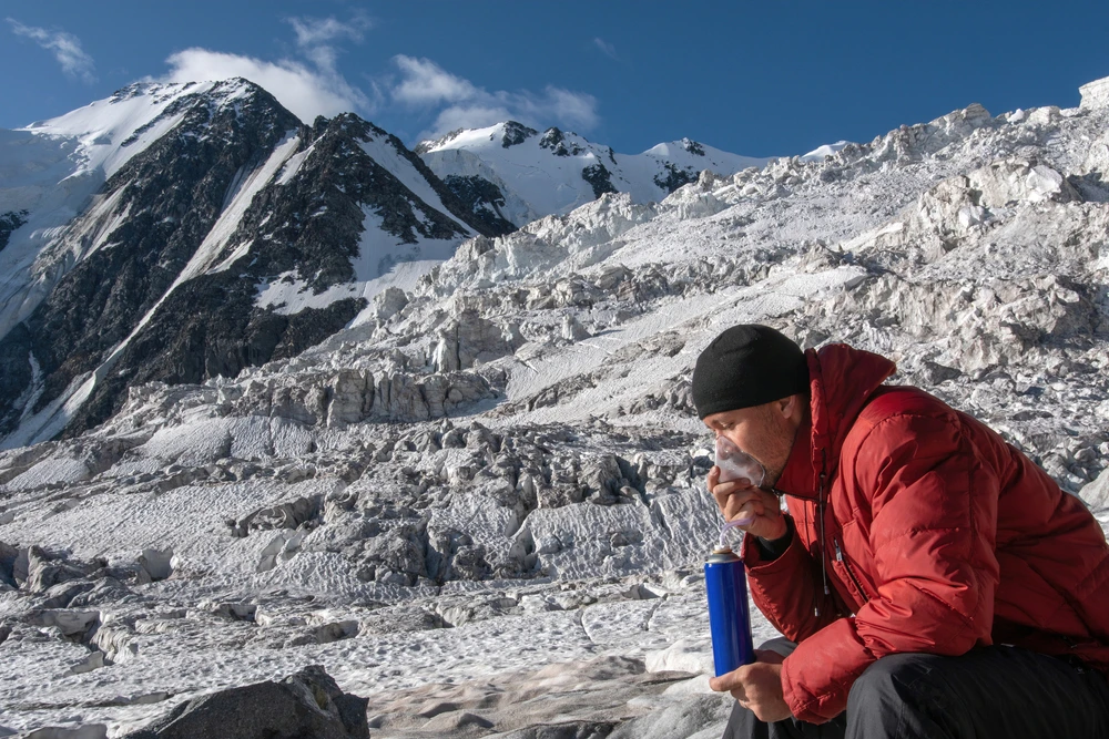
Altitude sickness is the body’s reaction to a high-elevation atmosphere. It occurs when one climbs to high altitudes quickly and is exposed to the thinner atmosphere. As the atmospheric pressure is low, you do not breathe the same amount of oxygen that you breathe at normal elevation. Due to the difference in oxygen levels, your body faces difficulties coping with altitude change and starts to show symptoms like headache, nausea, shortness of breath, and fatigue.
Altitude sickness is categorized into three types, which are :
- Acute Mountain Sickness (AMS)
- High Altitude Pulmonary Edema (HAPE)
- High Altitude Cerebral Edema (HACE)
Acute Mountain Sickness (AMS) is a mild and common type of altitude sickness, which is typically experienced at 2500 m above sea level. High Altitude Pulmonary Edema (HAPE) is a serious condition that affects your lungs due to the formation of fluid. Meanwhile, High Altitude Cerebral Edema (HACE) is the most severe form of altitude sickness, which causes the brain to swell.
Altitude illnesses are preventable by following proper acclimatization, hydration, maintaining a pace, and taking preventative medication before going to high-altitude destinations.
Common Symptoms of Altitude Sickness
As you are being exposed to a high-altitude region during trekking, mountaineering, or traveling, the risk of altitude sickness rises. Meanwhile, the symptoms of altitude sickness depend on the type of sickness you are experiencing. In case of Acute Mountain Sickness (AMS), the symptoms can be mild to moderate. Meanwhile, the situations of HAPE and HACE show severe and life-threatening symptoms.
Mild to Moderate Symptoms
The mild to moderate symptoms of altitude sickness include headache, nausea, vomiting, loss of appetite, and dizziness. You may also experience fatigue, exhaustion, weakness, and difficulty in sickness. These symptoms are common within 6 to 24 hours of exposure to high altitude and can be managed with proper rest, acclimatization, medication, and returning to low elevation.
Severe, Life-Threatening Symptoms
In case of HAPE and HACE, one may face severe life-threatening symptoms, including
- Difficulty in breathing even while resting
- Chest tightness and a constant cough
- Hallucination and limited thinking ability
- Loss of balance
- Severe exhaustion and limited movement
- Bluish lips or fingernails
In case of these symptoms, immediate descent and seeking medical attention are critically important.
How to Prevent Altitude Sickness During Nepal Treks
When you are trekking or involved in a high-altitude adventure, like mountaineering in Nepal, following preventative measures is important to minimize the risk of altitude sickness. The risk of altitude sickness can be prevented by following proper acclimatization, maintaining gradual pacing, hydration, and fitness, and taking medications.
Fitness and Support
Fitness is important to prepare your body to navigate the high-altitude trekking regions in Nepal. For destinations like Annapurna Circuit treks and Everest Base Camp treks, physical fitness is a must. However, supports such as gear, experienced guides, and logistical support are critical for progressing safely with a maintained pace to avoid altitude sickness.
Hydration and Diet
Hydration and diet are important for adjusting your body effectively and efficiently to high-altitude conditions. Drinking plenty of fluids and having nutritious and light food with high carbohydrates can be helpful in helping your body cope with a high-altitude region. Also, avoiding heavy and junk foods, alcoholic beverages, and smoking can help prevent symptoms of altitude sickness.
Acclimatization and Pacing
Acclimatization and pacing are most important when trekking in the high-altitude regions of Nepal. It is important to adjust and adapt your body to a high-altitude atmosphere. Resting properly during acclimatization at key stops for single or multiple days decreases the risk of altitude sickness. Proper pacing when ascending is important to adapt your body slowly to higher altitudes. It is important to avoid gaining more than 500 meters in altitude daily above 3,000 m.
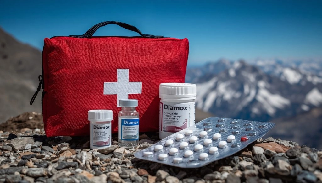
Medications
Medication can help to manage or prevent symptoms of altitude sickness. Medications like Acetazolamide (Diamox), Dexamethasone, and Nifedipine are used to treat or delay the complications of high altitude sickness. However, it is important to consult with a physician or doctor to get prescribed altitude medication for your safety.
When Should You Descend?
If you are experiencing the symptoms severely even after following altitude sickness prevention methods, then you must consider descending. You mustn't ignore symptoms at high altitude and descend in case of the following:
- You experience a severe and persistent headache
- Facing difficulty in breathing even during rest
- Facing confusion and hallucination
- Continuous vomiting and inability to drink and eat
- Rapidly degrading conditions
Descending for 500m to 1000 m can significantly improve your condition. In a severe case, you must descend and seek timely medical attention.
Conclusion
Altitude sickness is one of the common conditions you may encounter when trekking in the high-altitude region of Nepal. Trekking in high-altitude regions and mountaineering without proper acclimatization, inappropriate pacing, and lack of diet and hydration trigger the symptoms of altitude sickness. When trekking or adventuring in a high-altitude region, considering proper acclimatization and maintaining proper pace, rest, and hydration are important. Also, managing symptoms of altitude sickness through descent, proper rest, and medication is important.
Contact Trekkers Nepal if you are planning a high-altitude adventure in Nepal by trekking or expedition. Trekkers Nepal provides well-planned and personalized itineraries with expert guides, proper preparation, and acclimatization to ensure a low risk of altitude sickness while also making your adventure memorable.
